Blogs
Indian and World – Geography
May
GEOGRAPHY (Indian and World Geography-Physical, Social, Economic)
‘Geography is the study of man, his environment and interaction between the two’. This definition of geography tells you about the comprehensive nature of Geography and its vastness.
Geography has ‘overlapping’ topics which covers Environment, Economics (Human geography- Demograpy) and Current Events. One should always have an ATLAS while studying geography. It gives you more insights, makes your reading more meaningful and enjoyable.
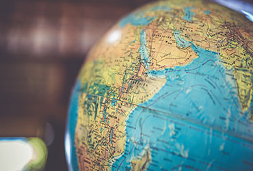
Geography Through Maps
Map being an intrinsic part of your entire preparation, aspirants often gets confused where to being.
Book Required
- One can buy Oxford Student Atlas or Orient Blackswan School atlas
- The most important material other than atlas is your National Daily (The Hindu, Indian Express etc.). This will help you to guess important geographical region in the news and prepare accordingly.
Benefits Of Studying Maps
- One can easily and efficiently cover physical and human geography through maps.
- Gives break from monotonous textual study.
UPSC tend to ask two types of map-based questions.
- One which is from static part and every aspirant is supposed to know.
- Other being dynamically mapped with current affairs.
Clarity Of Concepts
While studying Geography, clarity of concepts and it should be substantiated with appropriate facts. Everybody (from your seniors, people who have cleared the exam, friends, fellow aspirants, even the dabbawala’s, house-brokers in Delhi) keep talking about this clarity of concepts. But would not have explained to you what does it really mean
As per the recent trend, at least 15-20% weightage is given to History.
INDIA
- We recommend you to start with the political map of India.
- Try to remember the location of all states and Union territories, major cities, which state borders maximum no of states, which states share international borders.
- Try arranging the major cities north to south, east to west, which states have tropic of cancer passing through it etc.
- Which major rivers passing through the major cities, capitals etc for example Sabarmati from Ahmedabad, tapi from surat.
- Once thorough with political locations move on to the most important physical map
Try to segregate your preparation in different physical regions and reliefs.
1. Go through the Himalayas geographical extent, its division (lesser , middle. Greater), which passes connect which cities or region and lies in which state, any rivers which originates from these mountains and flows through these passes for example river Satluj enters india through Shipkila pass.
2. Be thorough with major rivers-their origin, tributaries, states and cities which they flow through, are they east flowing or west flowing rivers etc.
3. Northeast is very much important from prelims point of view. Go through the rivers, various hills (arrange them from north to south, east to west) important national parks in these physical relief. For example Government has announced Sela pass in previous budget, try locate in which state it lies, similarly on which river Bhupen Hazaraika bridge is built etc.
4. The peninsular India study should be focused on Western and Eastern Ghats, regional hills, national parks located.
5. The Island and marine location is of utmost importance. Pay special focus on Andamans since the news related to sentinelese is making buzz.
6. National Parks and reserves. UPSC off late have starte asking question from this area. There are more than 100 national parks so it is impossible to remember them all. Best strategy would be to read about the most important and in news ones. Try to know about their location statewise, rivers which flow through them, do they share any border with other state or neighboring countries.
WORLD
● This is another vast yet an important area. We shall give you very simple and effective strategy to master that.
Start continent wise. Asia being the most important one
- Go through different countries which are in news. For example North Korea so try see its neighboring countries and border.There two back to back questions in 2014 and 2015 regarding the central Asian nations because of high level government visit and connect central Asia policy.
- Try to arrange major cites again in north-south and east-west alignment
- Pay special focus to ASEAN group of nations and West Asia and question this location is a regular feature
Mediterranean Sea is a border of which of the following countries?
- Jordan
- xIraq
- xLebanon
- Syria
Select the correct answer using the code given below:
- 1, 2 and 3 only
- 2 and 3 only
- 3 and 4 only
- 1, 3 and 4 only
The area known as ‘Golan Heights’ sometimes appears in the news in the context of the events related to
- Central Asia
- Middle East
- South-East Asia
- Central Africa
*The above questions were asked since these regions were regularly in news.
- With respect to other continents just focus on important physical reliefs like deserts , rivers , great lakes of Africa and North America, countries which are landlocked or doubly landlocked, important straits, bays and most important cities, reliefs which is news. For example 2018-2019 is flanked with news on Venezuela, Northern Ireland etc. thus a simple yet confusing question could be expected from this.
We suggest you forming a study group of 3-4 members to cover the map portion in limited time duration. The key will be to revise it on regular basis and practice UPSC standard question to get confident on answering any questions from this area.
IKLAS IAS Academy has been smart enough to predict the question from this most challenging part which is both directly and indirectly reflected in UPSC prelims. Join IKLAS today.
Wish you good luck!